 WhatsApp
 Twitter

Nagaland is one of the most beautiful seven sister states of Northeastern India. In the arms of picturesque mountain valleys, this state invites a large influx of tourists every year. The state shares its borders with the country of Myanmar and has a rich cultural heritage. The valleys in Nagaland offer a plethora of activities to visitors, including trekking, camping and mountaineering. There are over 17 different tribes that inhabit this region, each celebrating their own distinct traditions. So, plan your next trip and cover all these valleys.
9 Valleys In Nagaland
Nagaland is home to a large number of verdant valleys, which attract tourists from all over the country. Here is a curated list of nine valleys in Nagaland.
1. Zunheboto
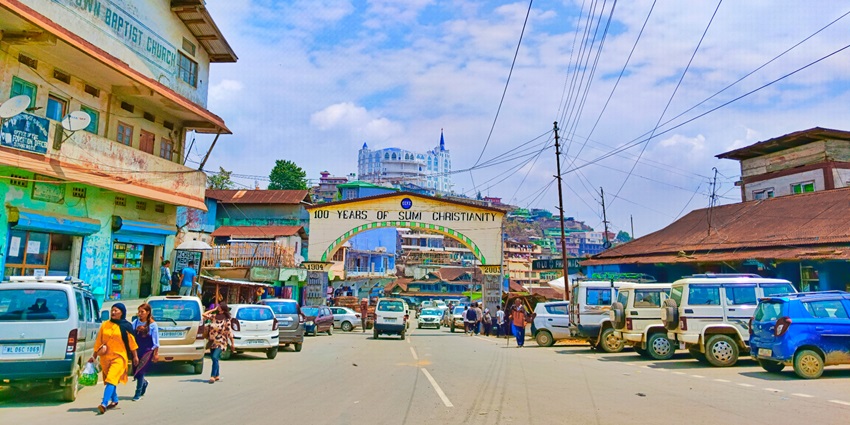
Photo: Achumi / Wikimedia Commons
Zunheboto Town is situated in the heart of one of the best valleys in Nagaland, which experiences moderate climatic conditions. While it can be quite cold during the winters, the summers are humid. This valley houses around 191 villages and is located strategically in the middle of the state. Zunheboto is famous for being home to the warrior Sumi tribe. The Zunheboto Church is an architectural marvel and was built by Honoholo K Chishi-Zhimomi between 2007 and 2017. Though Zunheboto has only a few valley areas, there are lush, green forests in adjacent areas. The Ghosu Bird Sanctuary is one of the most visited places in Zunheboto.
Distance From Kohima: 143 km
Suggested Read: Hill Stations In Nagaland
2. Dzukou Valley
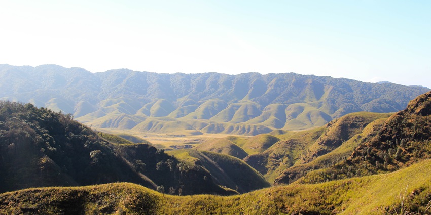
Photo: SeethaG / Wikimedia Commons
Dzukou Valley in Nagaland, is known to host a large number of trekkers every year. This valley lies very close to the state of Manipur and is named after the Dzukou River, the name of which translates to ‘cold waters.’ It soars high, at an altitude of 2438 metres and is filled with verdant trails. It is also home to a diverse range of flowers which are in full bloom during monsoon. There are also many crystal-clear streams which add to the magnificence of the list of valleys in Nagaland, making it a must-read spot in any Dzukou Valley Travel Guide.
Distance From Kohima: 14 km
3. Tizu Valley
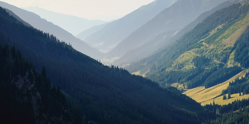
Photo: Shogun / Pixabay / Image For Representation Only
Tizu valley also gets its name from the river it houses, namely, the Tizu River. This valley is located in East Nagaland and is often overshadowed by the region’s most beautiful valley in Nagaland, Dzukou Valley. It has a biodiversity and livelihood network, which forms a reserve. What sets the Tizu River apart is that it joins the Chindwin River of Myanmar. The government of Nagaland has come up with efficient ways to develop communication and navigation in these waters. The Tizu-Zunki waters start from the centre of the state in Longkhim and flow through the Kiphire District. The riverbanks are perfect for evening strolls and add to the serenity of the atmosphere.
Distance From Kohima: 124 km
Suggested Read: National Parks In Nagaland
4. Tseminyu Valley
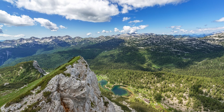
Photo: Ales Krivec / unsplash/ Image For Representation Only
In 1948, the Tseminyu region separated itself from the rest of Nagaland in terms of administration. Tseminyu is known for being home to the Rengma Tribe. The town of Tseminyu formed the route of many migrating tribes to the north and this makes its history replete with interesting details. Visitors can see abandoned accommodations of migrating tribes from the past, and reconstruct an interesting way of living. There are very early signs of civilisation found here, like remains of pottery and clay objects. Gravestones are also found peppered through the valley, and all these details make it an interesting archaeological ground for research, making Tseminyu one of the unique tourist spots in Nagaland.
Distance From Kohima: 50 km
5. Khonoma
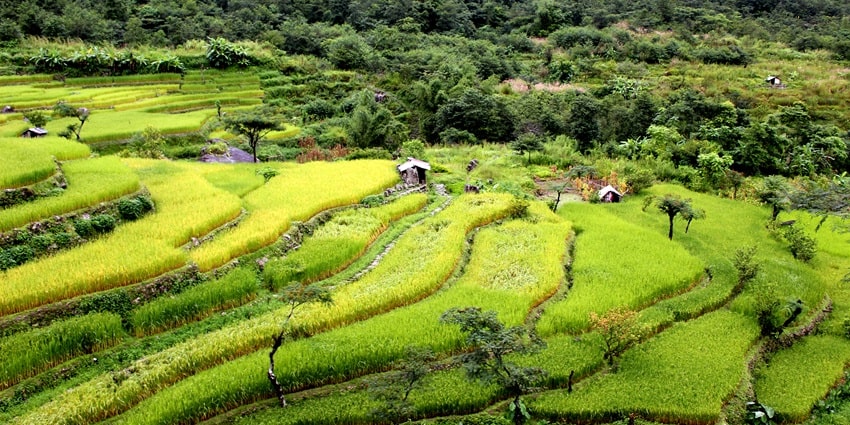
Photo: Girish Mohan P K / Wikimedia Commons
Khonoma is regarded as the ‘first green village of India.’ It is also called the Khüno-Ra by the Western Angami Naga Tribe which finds its home in it. It is largely popular due to the presence of diverse flora and fauna. The Asiatic Black Bear and the Clouded Leopard are two of the most sighted animals here. Khonoma’s efforts to conserve wildlife have been commendable since 1998 when a protected sanctuary for Nature Conservation was set up here. Khonoma is often associated with the spirit of warriors due to its active participation in India’s freedom struggle against the British, and the historic Khonoma Fort still stands as a symbol of that resistance.
Distance From Kohima: 20 km
Suggested Read: Scenic Places To Visit Near Kohima That Showcase Nature And Local Culture
6. Meluri
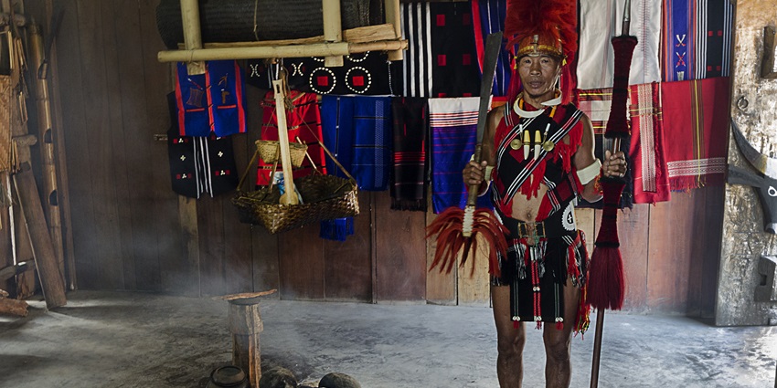
Photo: Bhrigu bayan / Wikimedia Commons / Image For Representation Only
The Meluri is an administrative subdivision in Nagaland and home to the Pochury tribe. It is commercially advanced, and visitors often come here to buy the purest form of brine salt. Meluri is replete with geological wonders which include unique rock formations. The Lion’s Mane and the Mushroom Rock are popular among tourists and locals alike. It is located in the Phek district and is home to a large number of friendly locals, who are happy to share folklore and the history of their traditions. The total population of Meluri is below 3000, making it a quaint and serene area with very little pollution.
Distance From Kohima: 156 km
7. Wokha
Photo: The Anonymous Earthling / Wikimedia Commons / Image For Representation Only
Wokha is the place for people who want to holiday amidst the songs of exotic birds and pleasant breeze by a riverbank. Doyang River flows through Wokha and the dam is effortlessly beautiful and is perfect for pictures and spotting Amur Falcon. The name of this place translates to ‘head count’ in the Lotha language. For sports enthusiasts, an interesting fact about Wokha is that it organises the Winter Cricket Challenge, the oldest cricket tournament in Northeast India. Mount Tiyi in Wokha is believed to be endowed with supernatural elements, housing the souls of the dead.
Distance From Kohima: 75 km
Suggested Read: Places To Visit In Nagaland
8. Peren
Photo: NpTruong28 / Pixabay / Image For Representation Only
Peren has quite a large population compared to other places in Nagaland, almost equivalent to that of the country of Seychelles. It is home to the famous Kuki tribe and the Zeliangrong tribe. Festivals like Meleinyi and Minkut are celebrated widely in this place. The Ntangki National Park And Reserve, formed in 1923, houses a diverse range of flora and fauna available for visitors to observe. Bamboo trees, Mahogany trees and Palm trees are found throughout the stretch of the park. Black storks and the Bluth’s Tragopan (Nagaland’s state bird) are also found in large numbers.
Distance From Kohima: 148 km
9. Mokokchung
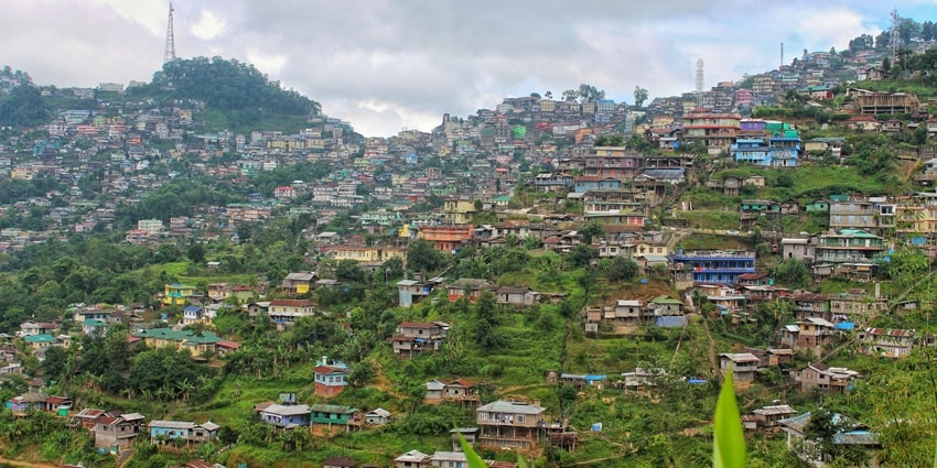
Photo: Rocktim2019 / Wikimedia Commons
Mokokchung is very densely populated and is a popular residential area in Nagaland. It is situated at a height of about 1325 metres and is the cultural hub of the Ao Naga people. During the colonial period, it was one of the first areas in Nagaland which housed the outpost of the Assam Rifles. The people of Mokokchung are known for their intellect and academic and artistic inclinations. The Dikhu River forms a valley in this region and the Longleng District. The Langpangkong Caves significantly attract tourists to this valley, known to have been a refuge to an Ahom King once upon a time, making Mokokchung one of the must-visit spots when exploring places to visit in Nagaland.
Distance From Kohima: 144 km
Suggested Read: Things To Do In Nagaland That You Cannot Miss Out On
Nagaland is replete with rivers which blend into one another and pass through hills, creating picturesque valleys. These valleys are known for the hospitality of the locals and cultural heritage and serve as a haven for animals. Tourists can enjoy the beauty of both flora and fauna in these locations. If you are looking forward to an adventurous trip to the valleys in Nagaland, then make your bookings with TripXL.
Cover Photo: Jackpluto / Wikimedia Commons


